Hennepin County Mesonet
Overview
Into the eye of the storm...
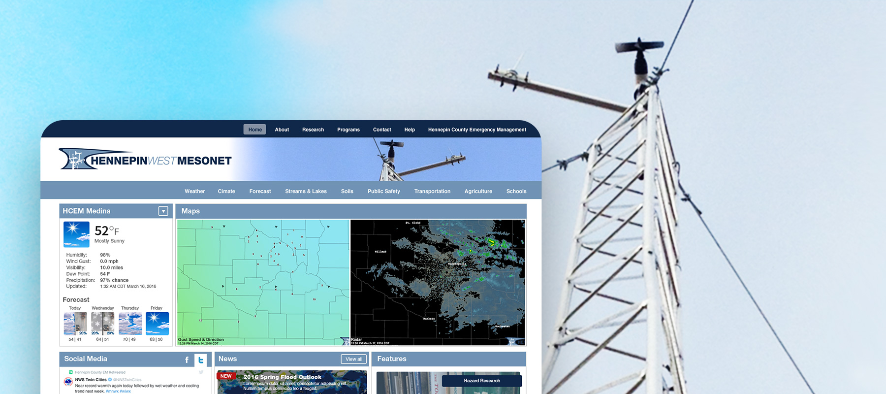
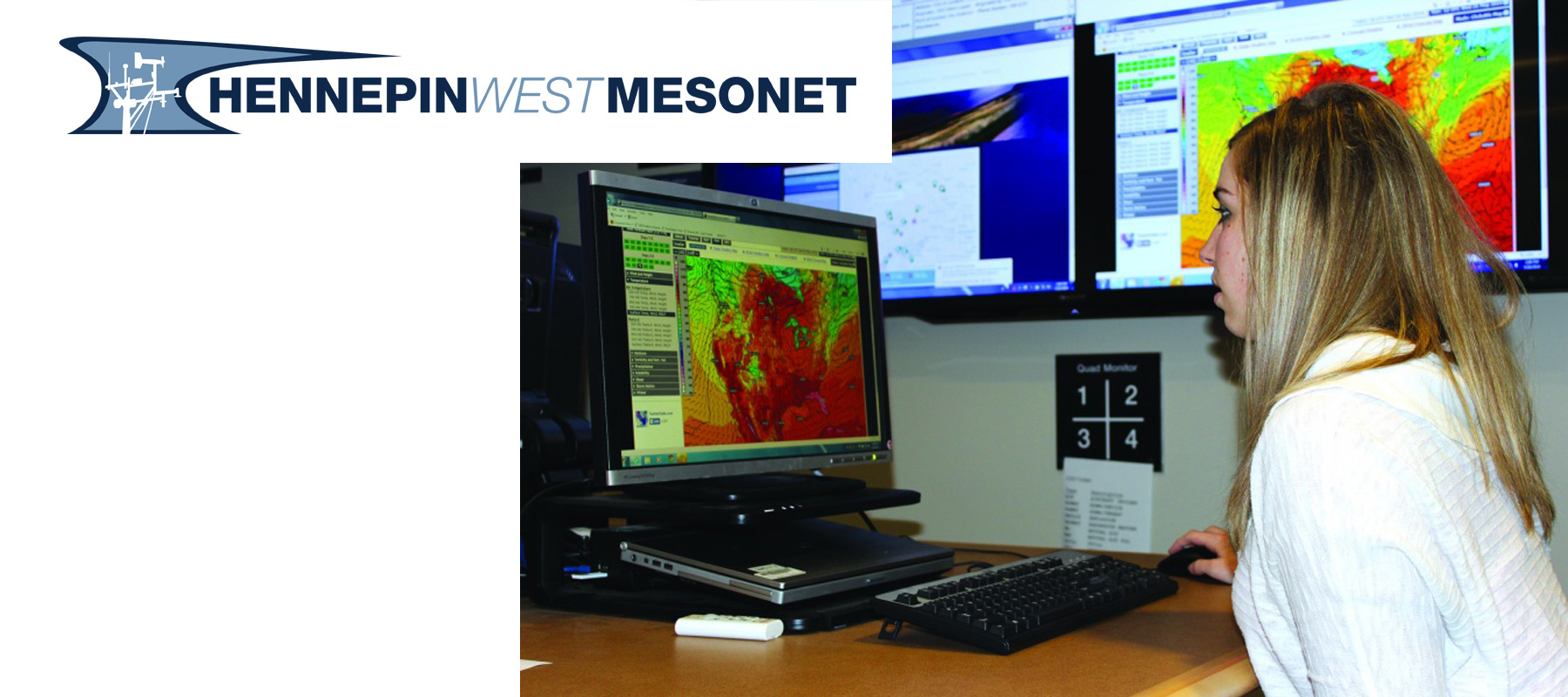
Hennepin West Mesonet is a weather monitoring system that provides real-time weather data for emergency management officials in the Hennepin County area of Minnesota. The system includes a network of weather monitoring stations that collect data on various weather conditions.
Product vision
A web portal that allows users to view and analyze the weather data both real-time and historically.
Discovered issues
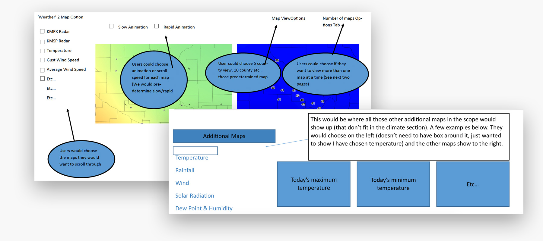
Map data translation was more complex than expected.
Product outcome
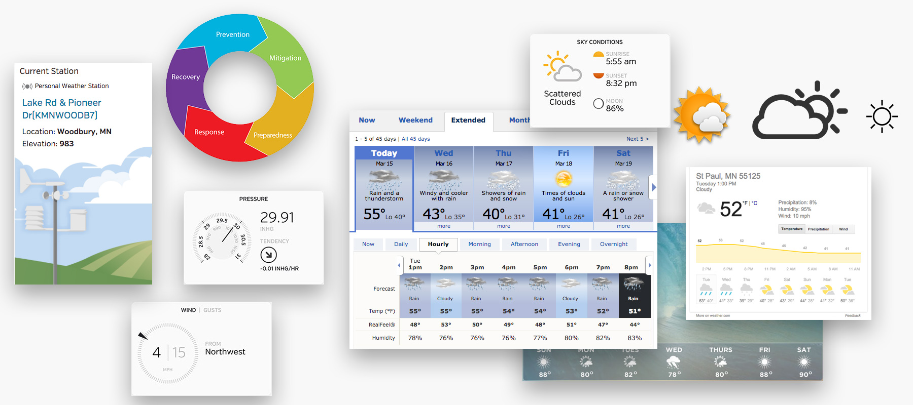
Users can view current weather conditions and analyze historical data with detailed local mesonet weather accuracy.
Mesonet Project Overview
Company
- Lighthouse Software Solutions
- Hennepin County Emergency Management
Team
- Client Manager
- Scrum Master
- UX/UI Designer
- Web Engineer
- Database Engineer
My roles
- UX Designer
- UI Designer
- Graphic Designer
Problem
Converting the static to dynamic
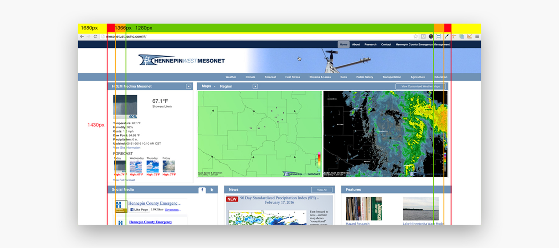
The previous Hennepin County Emergency Management site was a static wordpress site with archived maps and was not used to its full potential.
User challenges
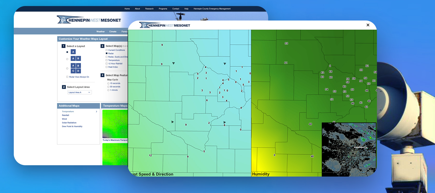
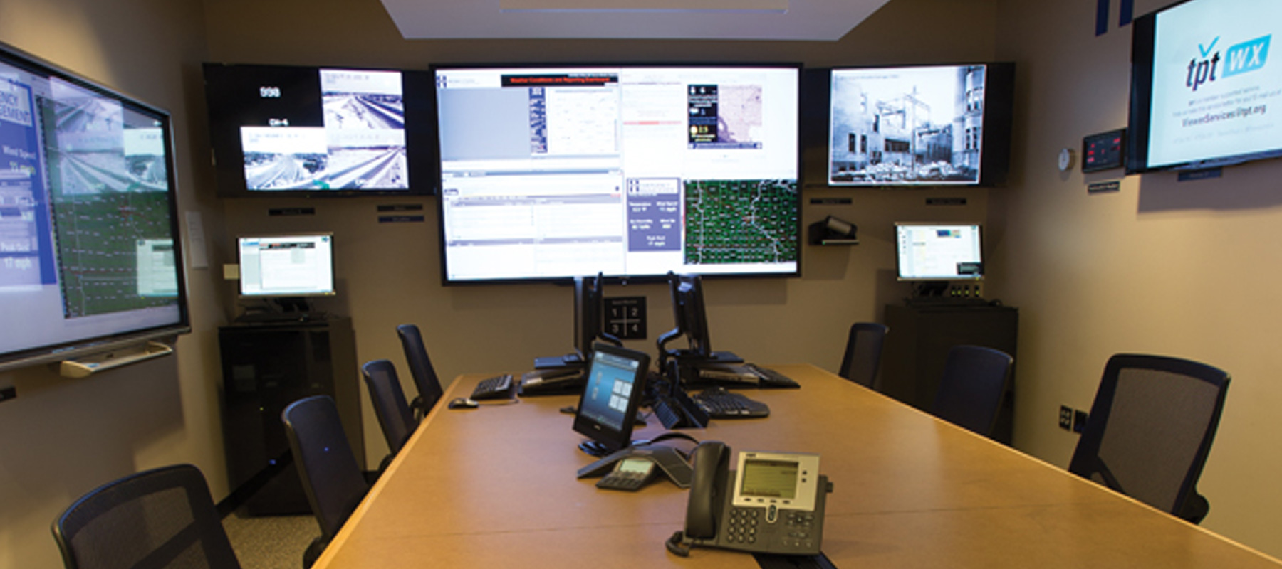
Live weather interface
Emergency management needs to view multiple live maps at once
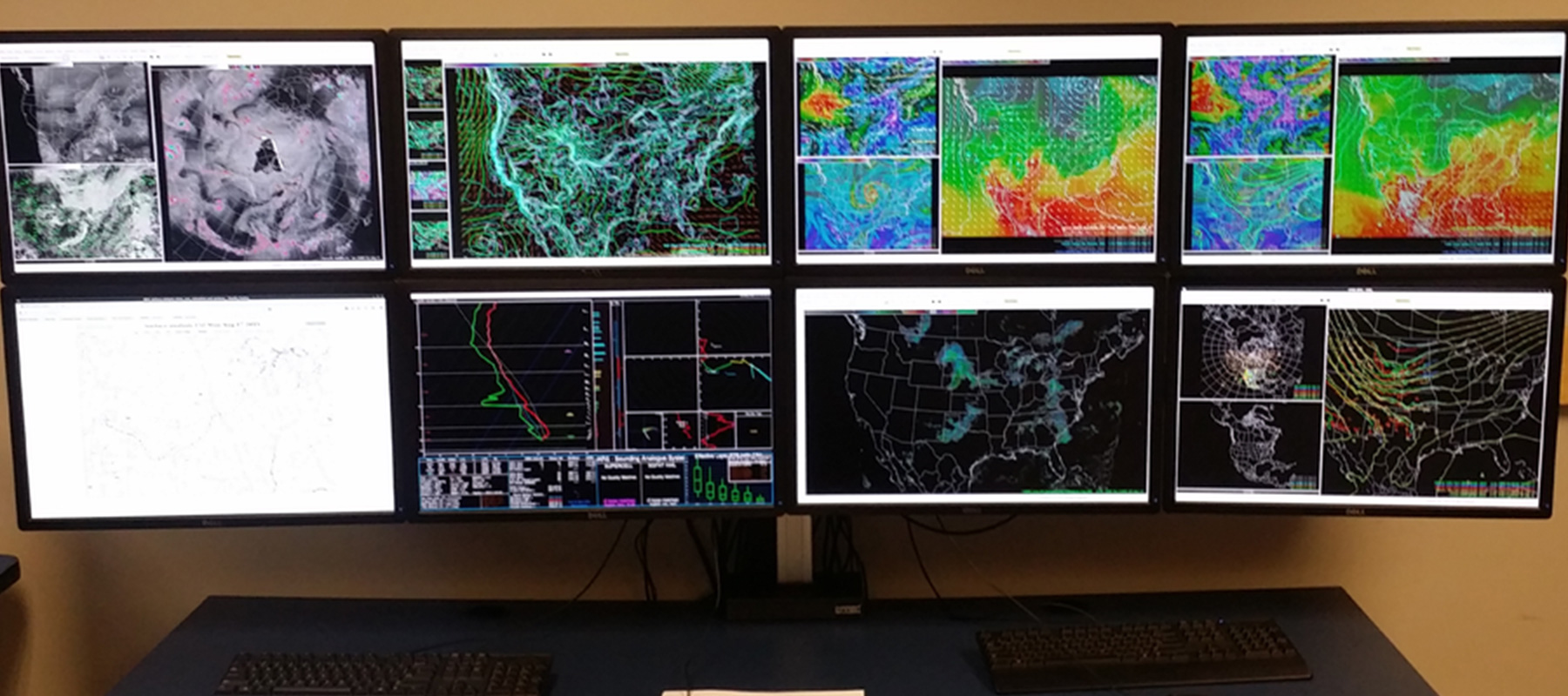
Endless data points
All of the local mesonets output data that need to be organized and utilized
Pro and student friendly
There also needs to be accessible archived news and historical data
Solution
Real-time emergency management tool
To make huge amounts of local weather data easily accessible to emergency management officials, Hennepin West Mesonet developed a web portal that allows users to view and analyze the local weather data in real-time.
Main product features
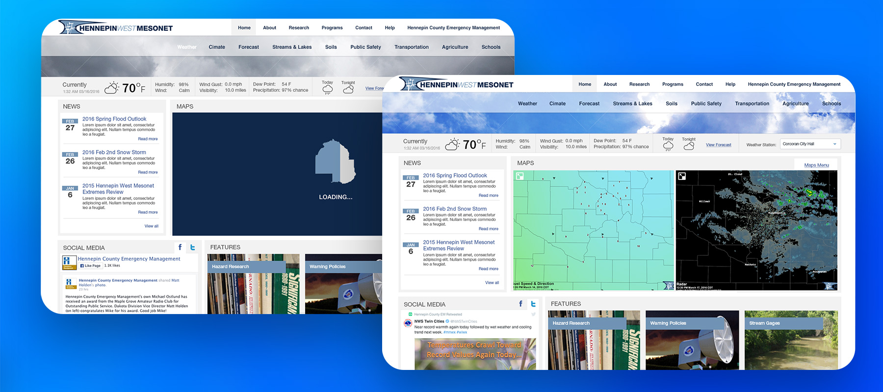
Full screen live weather
Users prefer large desktop and TV monitors for viewing
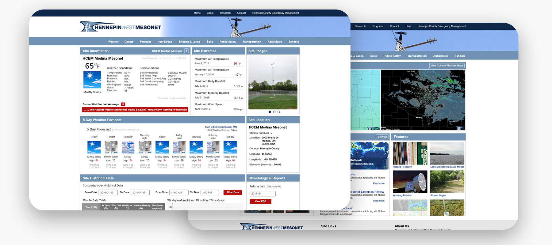
Historical data archiving
A cloud database was needed for real-time and historical weather data
Mesonet education
Increase engagement and have a learning resource for the local community
Discovery, Understanding & Ideation
Always there in an emergency
The Hennepin West Mesonet team is a part of the Hennepin County Emergency Management department, which is part of the Hennepin County Services division.
Business constraints
Project
Proof of Concept
Time
4 Months
Resources
Hennepin County Emergency Management Team
We met with the team and leaders multiple times to discuss the project. They described what they wanted to see and use. We also learned of their technology limitations and frustrations.
Industry analysis
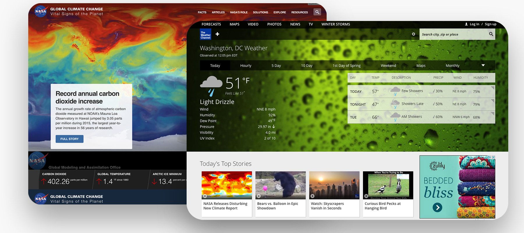
The weather industry and emergency management industry are minimal in design and content focused.
Market analysis
The commercial weather market is focused on larger images and maps and is mostly minimal in design.
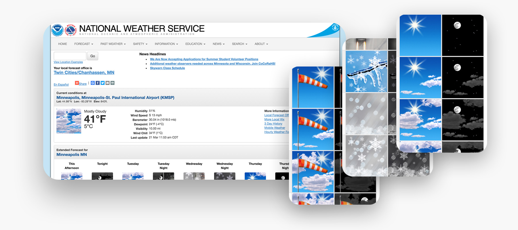
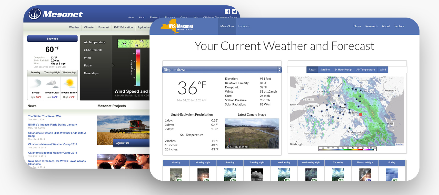
Product standards & innovation research
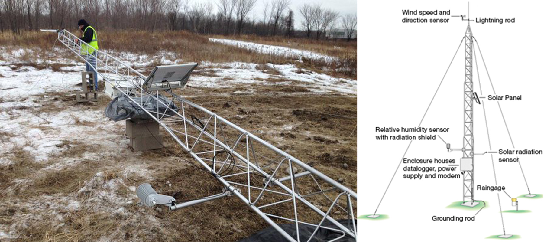
This project was a combination of web technology, meteorological technology and weather data that works in harmony to allow live utilization. The National Weather Service icons were used as the standard weather icons for the site.
Technology constraints
Technology
HTML/CSS/JS
JAVA/WeatherMapper
Resources
Off-site server and database, built for future on-site migration
Requests
Make the maps custom & fullscreen!
User research methods
The team had the opportunity to visit the Hennepin Emergency Management and Services building and offices in Minnesota. A minimal requirements document was created prior to the visit.
We used the opportunity for contextual inquiry and observed the work in progress and where it was taking place. Seeing the users in action was helpful, not just the location but also the modes of operation, the speed of immediate emergency needs and the slower research mode for historical data research and utilization.
1 Questionnaire
A website questionnaire was given to the client and their team.
6 Interviews
Members of the Mesonet team were interviewed about their needs, wants and challenges.
2 Workshops/Focus Groups
Workshops were conducted in the beginning for brainstorming and with the interactive mockup later in the process.
Ideation
Various ideas were researched and proposed. Most of the brainstorming and ideas came from government and commercial weather applications and systems.
Design system
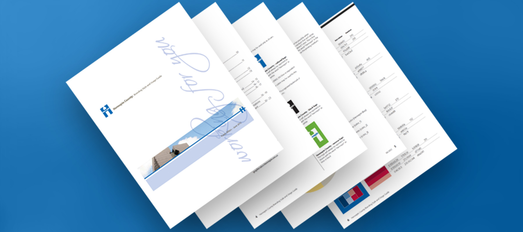
Hennepin West Weather Mesonet required the website to be in line with Hennepin County brand and style.
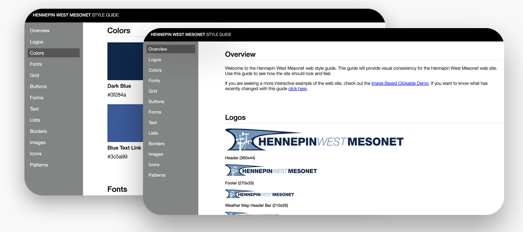
Once the site was completed, I created a web style guide specific to the new site for future reference.
Prototyping
Find the standard and do one better
Multiple prototypes were created to get more exact direction from the client. The major influences ended up being from other mesonet sites accross the country.
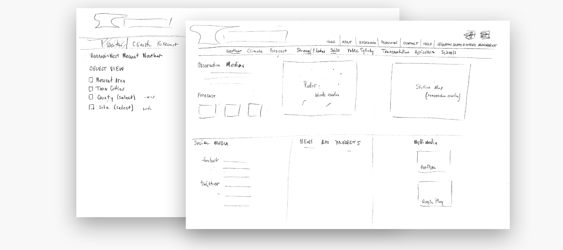
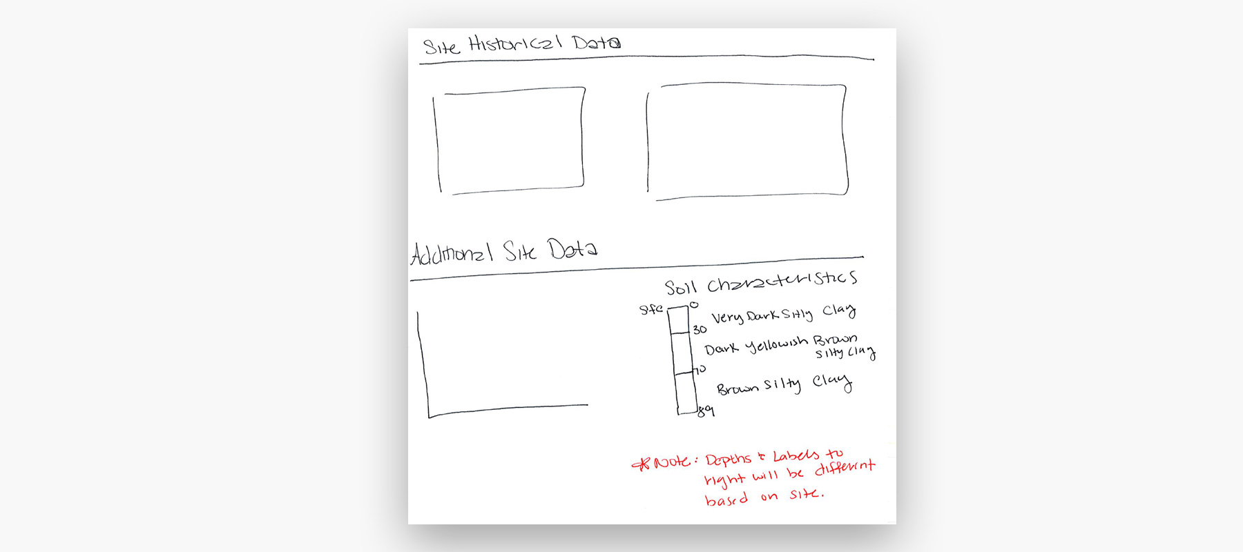
Low-Fi Exploration
The site design began with some pen and paper sketches.
Testing & Iteration
There were a number of back and forth sessions with constructive edits.
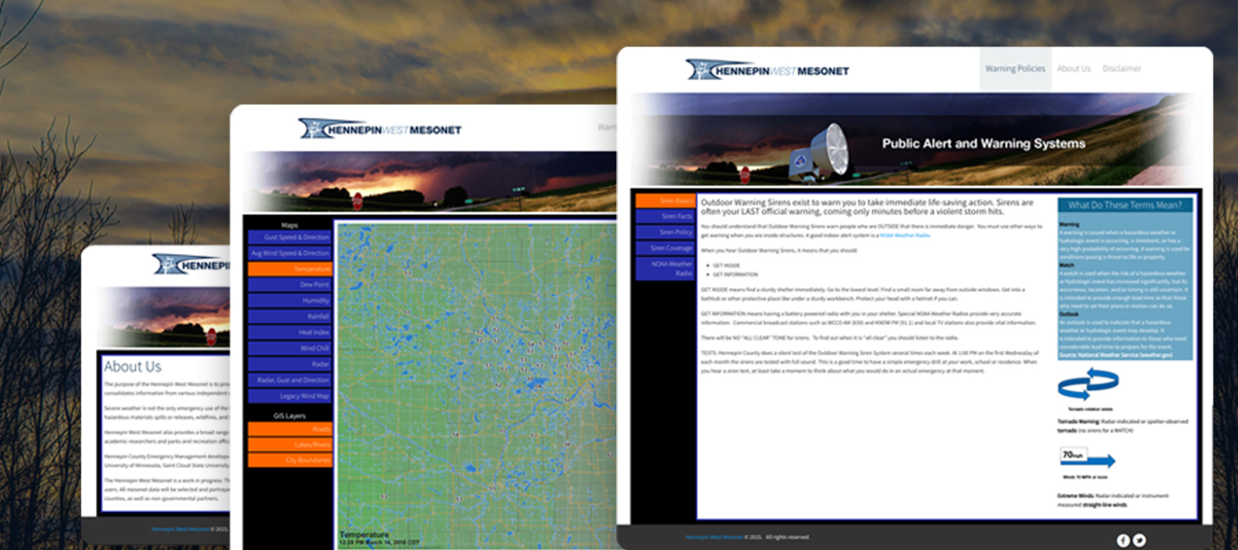
High Fidelity Prototypes
Site prototypes were created for clarity of direction and approval.
Validation
The weather looks clear and sunny
Officials reported that the web portal made it easier for them to access real-time weather data and view historical data, which helped them make more informed decisions about emergency response. The future alert system will also help officials to better prepare for severe weather conditions.
Outcomes
Prepared for the best and worst conditions
The web portal was deployed to emergency management officials in the Hennepin County area and has had a positive impact on emergency response and preparedness. In addition to improved emergency management, the portal also aids researchers, meteorologist and the public in understanding weather patterns and its impact. The ability to access historical data has also helped with research in understanding climate change and weather patterns. The team also included education materials and resources on the portal, helping to raise public awareness on weather safety and emergency preparedness.
Final designs
Product benefits
Increased usage
+34%
Increased accuracy
+20%
Raised awareness
+45%
* Based on client feedback.
Weather is becoming even more vital
Post-Launch, after proving effective, the proof of concept was a success. The county officials decided to move the project in-house and host it on their internal servers. They are also moving forward internally on many improvements, including a responsive version :)
Takeaways
The way the wind blows
Although the timeline was short, everyone worked hard and put in the extra time to get the site up and running.
What did I learn?
- I learned how detailed the study of weather can be.
- I learned how difficult Weather map data programming can be.
What would I do if I had more time?
- I would have designed a responsive or alternate mobile version.
- I would have made the forms & maps more interactive.
What would I do differently?
- I would have made more pre-built interactive map views and less traditional forms.
- I would have included more map overlays, callouts and access to customized view tools.
Overall it was a good project, a few technology challenges and limitations, the client was happy with the results in the end.
^ Top
~Fin
© 2023 William Polito